CHC Navigation AlphaAir 450 UAV LiDAR Solution

Call for Price

ALPHAAIR450INFORMATION

The AlphaAir 450 (AA450) is a major breakthrough in 3D mobile mapping technology, allowing its use by non-professional users in geospatial reality capture applications and to those who have never been able to access such technology before. The AlphaAir 450 offers ease of use and high precision capabilities at an affordable price point.

Have a Question? 919-467-7782

Description

The AlphaAir 450 (AA450) is a major breakthrough in 3D mobile mapping technology, allowing its use by non-professional users in geospatial reality capture applications and to those who have never been able to access such technology before. The AlphaAir 450 offers ease of use and high precision capabilities at an affordable price point.

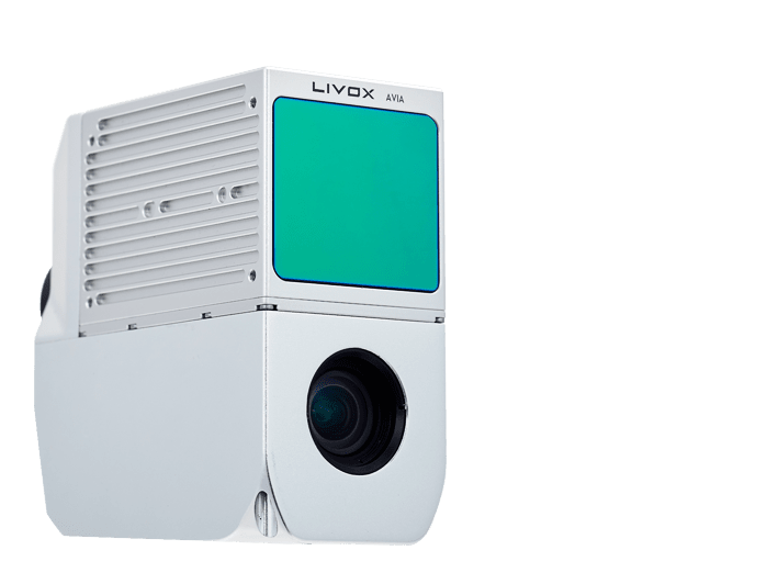
AlphaAir 450 is the next generation of CHCNAV LiDAR system, which is widely used for power line inspection, topographic mapping, emergency response, agricultural and forestry surveys, and more. This all-in-one, lightweight and rugged system integrates a high-performance laser scanner with an industrial-grade professional 26 MP camera and a high-precision inertial navigation system for quality data collection.

Additional information

Weight 6 lbs
Dimensions 16 × 16 × 11 in

Service

We offer 1-2 day turnaround on all repairs with parts in stock and emergency repairs are accepted anytime. We repair brands from all manufacturers.

Support

Professional, Reliable and Efficient Technical Support is the foundation of our business. We offer both free and paid training and support on a variety of equipment and software.

Rentals

Transit & Level offers a variety of rental equipment including GPS, Robotic Total Stations, Total Stations, Data Collectors, Lasers, Levels and other accessories on a daily, weekly, or monthly rate.